Well, there's the old saying about Michigan weather "If you don't like it right now, just wait, it'll change"
We were in shorts and sweatin a week ago...
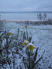
So far, just a "dusting"
Local TV covers it best :
SUMMARY:
A potential late season winter storm will bear down on northern Michigan this weekend. As low-pressure tracks across Illinois and Indiana Friday, clouds ahead of this system will thicken up through the day Friday with the area becoming overcast by late Friday evening. Low-pressure will then move into Ohio pulling colder air south wrapping it into the strengthening storm system. So, as the storm system increases in intensity, rain will develop and switch over to snow Friday night and become all snow by Saturday. Hard to believe after some area hit the 80’s earlier this week. Any snow accumulations late Friday night/Saturday should stay manageable with the least amounts west of Interstate-75 in the Eastern U.P. and west of U.S.-131 in the Lower Peninsula where by Saturday evening, 1-3” of snow is possible. East of these locations, closer to the low-pressure, higher snow totals are likely with 4-7” of snow possible by Saturday night. The winds will howl as well with gusts to near 40 mph possible Saturday into Sunday. The best chance for heavy snow will come Sunday as this storm system stalls out to our east and cold northerly winds drag in snow on the backside of this storm. It will be brisk with blowing/drifting snow; especially east of Interstate-75 in places such as DeTour Village, Rogers City and Alpena where there is the potential for 5-10” of snow. Locations west of the interstate will see significantly less snow in places such as Newberry, Petoskey and Traverse City where another couple inches is possible. The snow will slowly wind down by Monday morning with some rain mixing back in with the snow.
No comments:
Post a Comment